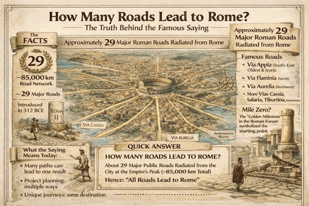
How many roads lead to rome — the truth behind the famous saying
You’ve heard the line a thousand times: “All roads lead to Rome.” But how many roads lead to Rome in reality? And why did people start saying this in the first place? In this guide, you’ll get a clear answer, a quick history of the Roman road network, and an easy way to remember the main routes—without getting lost in academic jargon. I’ll also show you how the saying turned into a metaphor you still use today.
Literally, ancient sources and modern scholarship point to about 29 major public roads radiating from Rome at the height of the empire. Culturally, the proverb means “many paths can lead to the same goal.”
What “all roads lead to Rome” really means
Let’s start with the idea behind the phrase. In daily speech, “all roads lead to Rome” means there are many ways to reach the same outcome. In the ancient world, Rome was the political and logistical heart of the West. Because so many main roads (viae publicae) started in the city and fanned out like spokes, travelers really could pick different routes and still end up in the capital. That visual—spokes on a wheel—made the proverb stick.
Now to your core question: how many roads lead to Rome? The best estimate for the big, official arteries is twenty-nine. These were the heavy-duty, long-distance highways that set the standard for engineering and speed. A classic study puts the network at ~85,000 km (53,000 miles) of roads overall, with 29 major public roads starting from Rome, the most famous being the Via Appia.
How the Romans turned a city into a hub
If you picture Rome at the center and the roads as rays of sunlight, you’ll get the idea. The city didn’t just have one great highway; it had many. A short sampler of the most important ones you’re likely to hear about:
- Via Appia (Appian Way) – The “queen of roads,” first laid out in 312 BCE by Appius Claudius Caecus, running toward Capua and then southeast to Brundisium (Brindisi) for access to Greece and the East.
- Via Flaminia – Heading north through Umbria, crucial for connecting Rome to the Adriatic and northern Italy.
- Via Aurelia – Skirting the Tyrrhenian coast northward.
- Via Cassia, Via Salaria, Via Tiburtina, Via Nomentana – Additional spokes feeding central and northern routes.
Why does this layout matter to you? Because it explains why the proverb felt literally true to ancient travelers. No matter which way you came from, there was an engineered path guiding you back to Rome.
Was there an official “zero mile” in Rome?
Yes—at least symbolically. Romans talked about the Milliarium Aureum (“Golden Milestone”) in the Forum Romanum, a marker associated with the idea that distances were measured from Rome’s heart. Whether every mile on every road was strictly calculated from that stone is debated, but the symbol cemented the city’s role as the origin point. When people asked themselves how many roads lead to Rome, they were really noticing how everything connected back to that center.
How the Romans built so many roads (and why it worked)
The network wasn’t luck. It was state-level engineering:
- Layered construction for drainage and strength (foundation stones, compacted gravel, and a paved crown).
- Straight alignments where possible, with bridges and tunnels cutting distances.
- Milestones and way stations (mansiones) to standardize travel times for officials, couriers, and armies.
- Military first, commerce second: roads moved legions quickly—but they also sped up trade, tax collection, and communication.
If you love hard numbers: the Roman road system is widely described as the most advanced long-distance network of the ancient world, reaching across Europe, North Africa, and the Near East—with the Appian Way often singled out as the first and most iconic route. For a reliable overview, see Encyclopædia Britannica’s coverage of Rome’s early highways and the Appian Way’s origins. [Read a concise summary here] (Britannica).
So… exactly how many roads lead to Rome?
Let’s answer plainly: about 29 major public roads (viae publicae) radiated from Rome when the network was at its peak. That’s your headline figure. It’s not a “magic number” for every minor lane—think of it as the big, named highways you’d find on a state map today. A well-cited transport economics study gives both the 29-road figure and the ~85,000-km total. [See the abstract here] (Elsevier/ScienceDirect).
Mini-takeaway: When someone asks how many roads lead to Rome, the historically grounded answer is 29 major ones, with countless secondary and local roads feeding into them.
Why the proverb stuck for thousands of years
A saying survives when it’s useful. Ancient travelers really saw Rome as the destination that many roads served. Over time, speakers extended the idea: many methods can achieve one result. The phrase shows up in medieval Latin as “Mille viae ducunt homines per saecula Romam” (“A thousand roads lead men through the ages to Rome”), often linked to Alain de Lille (12th century). Whether you’re talking project management or life choices, the image still works.
A quick tour of the “top roads”
You don’t need to memorize every name to understand the system, but these are the ones you’ll meet most often:
Via Appia (Appian Way)
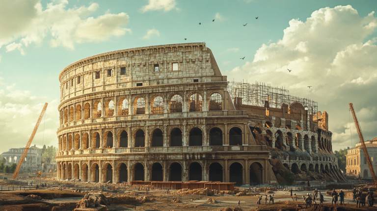
The first and most famous. Started 312 BCE. Used by armies, merchants, and later by grand tourists tracing classical history. It’s the go-to example in guidebooks because segments are still walkable today.
Via Flaminia
Rome’s northern lifeline, cutting through the Apennines to the Adriatic and on toward Ariminum (Rimini), opening routes to the Po Valley.
Via Aurelia
A coastal highway carrying traffic toward Etruria and beyond, essential for northern communications along the Tyrrhenian Sea.
Other spokes
Via Cassia, Via Salaria, Via Tiburtina, Via Nomentana—all channels that fed Rome’s markets and barracks while linking nearby towns into the wider imperial grid.
How travelers used the network (then and now)
Then: Couriers and soldiers relied on posting stations and standardized daily distances. The roads were built to hold up under weather and heavy loads, with drainage and straight lines to keep speed high.
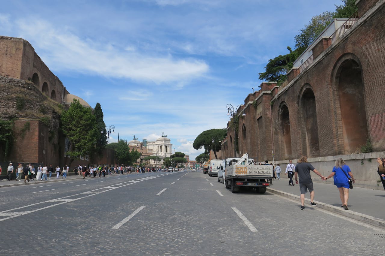
Now: You can still trace ancient alignments, especially outside dense urban cores. In and around Rome, surviving stretches—like parts of the Appian Way—offer the most vivid feel for those original basalt blocks and the long, straight perspective you see in photos.
Story time: following one “road to Rome”
Picture this: you’re a merchant in the 2nd century CE, hauling olive oil amphorae from Apulia. You pick the Via Appia because it’s direct, paved, and dotted with services. A few days later, you’re unloading near Rome’s markets, with milestones behind you and revenue ahead. Swap the horse cart for a delivery van and the amphorae for pallets, and the logic still holds—good roads shrink distance and pull regions into a single economy. That’s why the hub-and-spoke design mattered: it made the empire manageable.
People also ask (and you might, too)
Does how many roads lead to Rome mean there were only 29 routes?
No. The 29 number refers to the major public highways. Below those were regional and local roads that fed into the big arteries. Think interstates vs. state roads vs. local streets.
Which road was the most important?
Most sources put the Via Appia at the top—first built, hugely influential, and still visible. For dates and background, Britannica’s summaries on Rome’s early road-building are a reliable starting point.
Can you still walk a Roman road in or near Rome?
Yes. Portions of the Appian Way are walkable and give you that classic “straight-to-the-horizon” view. It’s one of the best places to feel the engineering under your feet.
Where did Romans get the idea that all distances start from Rome?
The symbolism comes from the city as a measuring point, often associated with the Golden Milestone in the Forum. Even if not every milepost literally tallied from that stone, the image of Rome as the zero point powered the proverb.
Common confusions (and quick fixes)
- “All roads lead to Rome” = every path is identical.
Not really. Routes differed by terrain, security, and season. The proverb means many ways can work, not that every way is equally good. - “Twenty-nine” sounds too exact to be true.
It’s an estimate for major roads reported in a scholarly context; it doesn’t count every feeder. That’s why you’ll see the figurative medieval wording “a thousand roads” in moral or poetic texts—because in real life, many paths indeed converged on Rome.
FAQ
How many roads lead to Rome, literally?
About 29 major public roads (viae publicae) radiated from the city during the empire’s peak. Secondary roads added countless connections.
What made Roman roads so durable?
Layered foundations, careful drainage, straight alignments, and frequent maintenance. Bridges and tunnels kept routes efficient.
Which was the first major road?
The Via Appia, begun in 312 BCE by Appius Claudius Caecus, initially linking Rome and Capua, later extended southeast.
Did maps show all these roads?
Ancient schematic maps like the Tabula Peutingeriana visualized long-distance routes across the empire (not to modern scale, but helpful for the big picture).
Why did the proverb survive so long?
Because the hub-and-spoke network was real, and the metaphor—many paths to the same goal—fits everyday life. From project planning to learning a skill, there’s rarely only one “right” route.
Wrap-up
How many roads lead to Rome? In practical, historical terms, about 29 major public roads radiated from the city at the empire’s height, with countless minor routes feeding into them. The layout made Rome the hub of the ancient Mediterranean, which is why the proverb “All roads lead to Rome” still means there are many valid ways to reach the same end.